Showing posts with label travel. Show all posts
Showing posts with label travel. Show all posts
Monday, November 25, 2013
Pleasures of touring Guizhou
I have frequently written about Chinese Americans victimized due to racial profiling by American law enforcement agencies. Dr. Su Haiping was one such victim. As reported by the San Jose Mercury News, his case has finally come to trial after nearly 6 years. Some of the proceedings in court has been reported by the World Journal, the national daily in Chinese, and I have provided a translation below.
Court Case on (violation of) Privacy Rights Opens, Su Haiping Asking $5.2 Million Compensation.
Lawyers for UCSC agriculture scientist Su Haiping on December 6 accuse US government of invasion of his rights to privacy, pointing out that after FBI concluded that Su represent security risk, the management of NASA Ames reveal the findings to Su’s co-workers and at the same time took away Su’s access to Ames Research Center. (Thus) causing heavy damage to Su’s professional reputation and his psychological wellbeing. Representative for the plaintiff is asking compensation of $5.2 miillion from the federal government.
Su’s invasion of privacy case occurred in 2008, at the time when he was working as one of expert analysts for UCSC’s University Affiliated Research Center. The principal source of funding was from NASA. At the time, Su had already been working at the Ames Research Center for nearly 3 years.
Government attorney countered that the difficulty of determining the invasion of a person’s privacy is very high, because such cases involves under what circumstances, to whom and what was said. According to court documents, defendant denied invasion of Su’s rights to privacy. Furthermore, the government attorney believes that disclosures by FBI and NASA were not very harmful to Su, because even though he can no longer go to Ames to work, he remained employed by UCSC.
Su’s case began in July of 2007 when he filled personal information on e-QIP for the purpose of getting NASA approval for facility entry in 2008. After submitting to NSA, he received the entry pass in January 2008 uneventfully. According to Su’s attorney, e-QIP was a new tool used by the government to check on staff after 9-11.
Michael Reedy, Su’s attorney, pointed out that NASA never obtained Su’s permission before turning over the completed e-QIP form to FBI. Defense objected and Davila, the presiding judge, ruled that the hearing does not include the e-QIP matter.
Beginning February 2008, FBI agent Sherman Kwok along with NASA personnel interviewed Su twice, both times in a windowless room at the (Ames) research center.
On March 21, 2008, Su went to Oakland to undertake a FBI administered lie detector test. Su was distraught after the test. According to court documents, FBI agent Kwok told Su that the lie detector results were not good, but there were no means to do a retest. The results were sent on to NASA.
According to Su’s testimony on December 5, June 24 2008 was a unforgettable day in his memory. On that day, Robert Dolci, head of NASA Ames security gave Su a letter signed by Dolci. The letter stated that according to results of investigations, the center considers Su a security risk to NASA’s intellectual property and thus is revoking his access to Ames research center (and the right to work there).

Monday, May 28, 2012
Reflections from travel through Central Asia
An intrepid world traveler most likely won’t find a tour of central Asia daunting, but others just might. Unless you are accustomed to dealing with border crossing that require schlepping all your personal baggage across long no-man’s land—barbed wire fences, check points manned by steely-eyed soldiers carrying rifle, some with fixed bayonets, that speak no English—this would be the lowlight of the tour you don’t need.
Ironically, central Asia used to be a vast, open but loosely defined region that separated the European kingdoms in the west and the mysterious Cathay in the east. Today, this region is artificially divided into countries, all ending in “-stan:” Kazakhstan, Kyrgyzstan, Tajikistan, Turkmenistan and Uzbekistan. (Afghanistan is also part of Central Asia, but not presently recommended for even the intrepid traveler.) The Stans became independent countries upon the dissolution of Soviet Union in 1991 and they apparently took the borders created for them by Stalin in the 1920’s very seriously. Crossing from one Stan to another is strictly monitored and controlled.
 |
| Mountain range as seen from a Bishkek hotel |
This part of the world was home to fabled empires at different times and overlapping territories that belonged to such ancient people as Scythians, Parthians, Sogdians, Bactrians and Kushans. Much of their cultures have been lost over time abetted periodically by total massacre and destruction in the hands of ruthless invaders resulting in a consequent loss of historical continuity. It shouldn’t be surprising—though I was initially—that we found frequent mention of Chinese sources to establish and authenticate the archeological finds on display in the museums we visited. Neighboring China, after all, has uninterrupted historical records that kept track of the interactions China had with various peoples in the west.
One of the museums attributed “the ambassador from China in 109 BC” as the beginning of trading on the Silk Road between China through central Asia and the West. I was thrilled by this apparent reference to Zhang Qian, the emissary sent by Han Wudi to form alliances with the kingdoms in central Asia. Zhang Qian is an important historical figure well known to school children in China. At first I thought the reference was an independent validation of the years he spent in central Asia, but upon further reflection, I asked myself, was it merely another citation of the same Chinese historical source?
Invasion by Alexander from Macedon around 330 BC became the first major defining event for this region. In his campaign against the Persian Empire, he ran over most of central Asia in part because his opponents didn’t know how to overcome soldiers marching in phalanx formation, the leading warfare technology in its day. When he got to the capital of Sogdiana, near today’s Khujand in Tajikistan—as the local guide related to us—he met fierce resistance, which he solved by marrying Roxanne, the princess of the local king. Thus a romantic story from the ancient era was born. The influence of Greek culture to central Asia and beyond to India and China can be attributed to Alexander’s conquest.
 |
| Statue of El Khoresm in Khiva |
The Mongolian invasion led by Genghis Khan in the 12th century was the next cataclysmic disaster to strike this region. He left a wake of annihilation and destruction in his path as he swept through on his way to Europe. Much the memory of the people and evidence of their culture were erased by the Mongols. Our guide in Kunya Urgench explained that the tragic outcome could have been averted save for a grievous misunderstanding. Genghis Khan had sent emissaries to the emir then seated near Kunya Urgench to establish trade relations. The emir got bad counsel and looked down on the unwashed horsemen and beheaded them. A furious Genghis then mounted a fierce assault that eventually overcame the fortress.
Annihilation of the population and leveling of the city was a customary practice to intimidate the next opponent and convince them that surrender to avoid slaughter was a wiser alternative. Genghis was not the first to use this practice. Alexander did the same some 1500 years earlier when he invaded southern parts of Greece.
The next ruthless ruler to dominate central Asia was Timur, whose detractors derisively called Timur the lame, which in the West became Tamerlane. Timur was home grown from a village outside of Samarkand who rose to conquer much of this region roughly a century and a half after Genghis Khan. He made Samarkand his capitol and built a great city for posterity. He also destroyed other cities and kingdoms that rivaled his power, such as the kingdom of Khorezm based in Khiva. At its peak, Timur’s empire rival in size to that of Genghis Khan and Alexander. In 1405, nearing 70, he died on the road as he was preparing to invade China. The threat of his invasion was said to lead to Cheng Ho’s sailing the seven seas as the Ming Emperor sought alliances that might mitigate the threat of Timur.
Peter the Great had designs on this region as early as 1717 but took the Russian military another 150 years to conquer and incorporate central Asia into its empire. After the Bolshevik Revolution, central Asia became part of USSR. To discourage insurrection and large-scale rebellion, Stalin somewhat arbitrarily divided this region into the aforementioned 5 Stans. At the time, each autonomous region had to have a minimum 1 million population and over 50% belonging to one ethnic group, such as Kazakh, Kyrgyz, Tajik, Turkmen and Uzbek. Some of the borders, reminiscent of the fine art of gerrymandering in the US, reflect the need to meet the criteria.
 |
| Ivory rhyton on display at Hermitage |
The preceding sketch of the history of this region is no where comprehensive and perhaps not even precise but is, I believe, a minimum framework necessary to understand today’s central Asia.
On the tour, the most striking thing I noticed was the people of central Asia. They come in all sizes, shapes and coloration and as non-homogeneous as one can imagine. Some are blond and pale and some look Asian, but most seem to fall in gradations somewhere in between. They could be easily mistaken for someone from Mexico, or Morocco or Iran or Egypt or India or Italy. Remarkably, they mix and mingle and seem oblivious to differences between themselves. I could not detect any ethnic sensitivity or tension as we mingle with them on the streets and bazaars. In various times, nomads from Siberia, Mongolia, Manchuria and western China have migrated or passed through from the east, as have people from Russia and Ukraine from the north and Turks and Greeks from the west and Persians from the south. With such a long period of intermingling, perhaps it’s natural that they stopped noticing the differences among themselves.
Even though the dominant religion is Islam, the people’s attitude is quite secular. Few pray five times a day, most consider themselves devout if they regularly pray on Fridays. During the three weeks we were there, we did not hear the call to prayer even once, unlike our experience in other Islamic countries. Perhaps this is a legacy from the Soviet era when practice of religion was actively discouraged.
Another Soviet influence is the universally accepted notion that education is important, even for women. Free public education through the 9th grade seems to be the norm in all the Stans. Every tour guide seemed quite proud of their national university and seemed perplexed that I would asked if the university had any foreign students. (The answer was they do not.)
The sudden dissolution of the Soviet Union seemed to have left the Stans poorly prepared for nationhood. All gravitated to some form of strong man government, and, except for Kyrgyzstan, have enjoyed the support of the population to varying degrees. In the case of Kyrgyzstan, the first two presidents were thrown out of office, the third, a woman, accepted the emergency appointment for one year and voluntarily stepped down for the next elected president.
Economic development among the 5 Stans seems uneven, largely dependent on whether or not the particular country possesses deposits of oil and gas to subsidize the economy. Kazakhstan and Turkmenistan have plenty of oil and gas and thus have stable economies. Uzbekistan does not and is wrestling with ongoing inflation. The official exchange rate is 1800 som to a dollar. At restaurants, if you offer to pay in dollars, they offer a black market rate as high as 2850 to a dollar. Kyrgyzstan is rich in water and natural scenery and Tajikistan is the least economically developed of the five.
Uzbekistan’s attempt to control inflation is apparently to exert tight monetary control. We were told that the daily receipts of enterprises, large and small, are collected by the state at the end of the day and deposited in the state-owned banks. This would allow the state to monitor and control the circulation of their currency but apparently the state can’t help resorting to printing more currencies as their remedy. The consequence is that everybody carry wads of 1,000 som bills and are experts at counting stacks of bills quickly and accurately. On a flight from Urgench to Tashkent, I happened to stand next the interpreter for a World Bank team visiting the country. I asked her if the World Bank was recommending an open economy that welcomes foreign direct investment, she agreed that would be a step forward.
China’s influence in the local economies is readily evident. The bathroom amenities as well as the sinks and toilet bowls in many hotels are from China. In the bazaars, used fertilizer bags from China are popular for holding whatever commodities the stall operator is selling. In Bishkek, I bought an electrical plug converter for the equivalent of $1.10, made in China of course. That little purchase was essential to power my iPad, mobile phone and camera for the rest of my trip.
The roads in 5 Stans are extremely uneven. New roads are excellent. A JV, we were told, built the toll road from the border to Khujand in Tajikistan, with a Chinese company. While driving from Bishkek to Lake Issyk-Kye, we were mostly on a road still under construction. When completed, it was going to be a major arterial highway from Kyrgyzstan to China. At a roadside restaurant, I was delighted to take over from our guide and ordered a Chinese meal from a menu with dishes written in Chinese.
 |
| Group photo of American travelers with Uzbeks in Tashkent |
This part of the world has not seen many tourists from America. When they asked and found out that we were from the US, we were invariably greeted with warm, welcoming smiles. In Uzbekistan, especially the young people loved to have their photos taken with us, the American tourists, and they would frequently approach the women of our group and ask for group photos with us. We felt like celebrities. The people in Tajikistan loved to have their photos taken by our camera and were pleased to see their images on our camera. The people of Turkmenistan were more formal and distant and did not encourage taking of photos.
Driving into Ashgabat, we saw gleaming white marble office buildings, white marble apartment towers, spectacular monuments, broad boulevards and fountains everywhere. Being the capitol of Turkmenistan, Ashgabat was probably the most ostentatious, but the other major cities that we drove through also contained spectacularly looking edifices. On the other hand, the highways between the cities are not in good condition and rather than drive, it was quite inexpensive to fly, under $20 per person from Mary to Ashgabat and from Ashgabat to Dashogus. Fuel in oil-rich Turkmenistan must be quite cheap.
When we got to Samarkand, one of the first stops was to visit a family still making paper from the fibers of the mulberry tree in the traditional way, i.e., by manual labor. I found an interesting historical footnote related to this stop. I discovered that Samarkand was the first place to make paper outside of China and they learned papermaking from the Chinese prisoners of war because of a pivotal battle that took place in 751 AD. Taking place in the valley of Talas in today’s Kyrgyzstan, a force of soldiers from Tang court fought a force led by the Arabs. The Chinese suffered a devastating defeat as some 2000 soldiers were taken prisoner; among them were skilled craftsmen who knew how to make paper and pottery. Thus was how the papermaking technology was transferred to the west.
While largely forgotten, it has been argued that this battle had a major impact on history. After this battle, the Tang court turned away from central Asia and lost interest in advancing its sphere of influence westward. Even though the Arabs won the battle, the logistical challenge of supporting their army over great distances may have also discourage their expansionary ambitions. They too turned away to consolidate their control in central Asia.
Travel tips, if you decide to visit central Asia:
All the electrical outlets use the two round pin configuration. If you don’t have an adapter at home, you can easily buy one in bazaars and street-side stalls upon arrival.
Most of the major stops on the Silk Road are in Uzbekistan. So if you would rather not deal with the hassle of crossing borders by foot, just book your tour for Uzbekistan.
As you enter Uzbekistan be ready to accurately complete the customs form and declare the amount of currency you are bringing in. Avoid hassle by making sure that you report no increase in the amount of currency you are taking out on departure.
Travel as light as you can and make sure your luggage has sturdy wheels. Perhaps because of perceived threat to airport security, cars and buses are not allowed to drive up to the terminal door. Instead, you are dropped off some distance away and have to haul your luggage to the terminal.
Bring plenty of US currency in small denominations, which will be handy to make purchases and as gratuity. The bills should be in good condition free from tears and unsightly wrinkles.
Hygiene standards are quite high everywhere we went. We ate fresh fruits, cucumbers and tomatoes and none of us got sick.
Do bring along an umbrella.
We booked our tour with East Site Travel, based in New Jersey with offices in the 5 Stans. You will find their website interesting and informative.
For those of you interested in more photos and less verbiage, I have produced a photo book on Shutterfly that you are welcome to access and view.
For those of you interested in more photos and less verbiage, I have produced a photo book on Shutterfly that you are welcome to access and view.
Friday, December 23, 2011
Autumn in Jiuzhaogou, 九寨沟

The natural scenic beauty of Jiuzhaigou was not "discovered" until modern times. The Tibetans that reside in the nine villages of this "Y" shape valley knew about its breath taking scenery, of course, but this valley is located in such a remote northwest corner of Sichuan that it was unknown to the Chinese in ancient times. For this, today's visitors are blessed with the total absence of man-made edifices and calligraphy carved into rocks. All one sees is mountains, and strings of mirror smooth lakes connected by cascades, water falls and running stream.

To visit Jiuzhaigou during the autumn foliage colors is to take a out of the world journey. The serenity and beauty literally takes ones breath away. Most of the fall color comes from the oily pine tree, a pine tree that is not evergreen and the color change only lasts about two weeks. Thanks to the advice of Dragon Delight, our tour operator, we were in Jiuzhaigou in the last week of October and witnessed the peak of nature's display.

 The Chinese authorities deserved all the kudos for taking the most ecologically friendly route in developing this valley into a tourist attraction. Some examples of their green policy: Only park operated buses are allowed inside the park. Visitors are allowed to walk only on designated walkways. Hundreds of miles of footpath were constructed out of wooden boardwalk. The wooden planks were grooved to improve slip resistance. Plenty of rest pavilions, toilets and trash receptacles dotted along the parthways. Unlike toilets in many other parts of China, these toilets were oder free and even featured water less urinals.
On our first day, our group of 12 rented our own park operated minibus and driver. It was a particularly crowded day and by renting our own vehicle, we could skip around various stops and alight where it was least crowded and avoided the jostling crowd. The next day, a few of us went into the park on our own. We got off the park bus about mid way and walked downhill, following the path along the strand of lakes. It was a magical walk to be savored especially for the time when we've become too old to tour again.


The town of Jiuzhaigou came into existence because of the park. There are now a large assorment of hotels to choose from. There are however only two 5-star hotels in the area. The Sheraton is within walking distance to the entrance of the park. The Intercontinental is more than half hour drive from the entrance. The feeling of staying in the latter is more like staying in a self-contained integrated resort because of its isolated location.

To get there: There are direct flights from many of China's major cities to JiuHuang airport. Or, fly to Chengdu and connect from there. You can also drive from Chengdu but that would be a long ride requiring a very long day.
Saturday, August 13, 2011
Nouveau Art is Thriving in Tibet
Most people get their information on Tibet based on declarations from Dalai Lama or his exiled followers residing in the west. Since these sources have not been to Tibet for decades, people can be expected to have at best a partial idea of what today's Tibet is like.
Those that have visited Tibet are likely to have a more well-rounded impression of what Tibet is like today. By touring various temples and souvenir shops, visitors would have been exposed to the richness of traditional Tibetan art embedded in religious objects and takeaway thangkas.

Very few, however, would know that there is such thing as modern Tibetan art and the art is dynamic and evolving in dramatic directions. My good friend, Dr. Cyrus Hui knows. A PhD economist and former banker, he became fascinated with Tibet, its culture and people, and he visits there often. He has written a historical fiction based on his Tibetan experiences.
He got to know some of the artists and had decided to help promote the new Tibetan art by opening an art gallery in Lhasa in late June 2011. See his eloquent discussion of the evolution of Tibetan art on the website of his gallery.
Many years ago, Cyrus was the first to recognize the universal appeal of paintings from Vietnam by artists trained in French impressionism. He bought the first collection of paintings back to Hongkong that became the seed for Galerie LaVong, the first gallery to launch its business exclusively on Vietnamese art.
Owned and operated by Shirley Hui, Cyrus' wife and good friend, the gallery in Lan Kwai Fong, has become the place where trendy new art is first unveiled. Prior to opening of the Lhasa gallery, a selection of Tibetan art was shown at Galerie LaVong with a gala in mid June. A selection of Tibetan art depicting its versatility and diversity can be seen at the end of the blog.
By opening an art gallery on Tibetan art, Cyrus is doing more than introducing today's Tibetan culture to the world. He is also explicitly saying: "Look, Tibet is a thriving place where its artists are free to experiment, innovate and create." Can we say the same for the residue of Tibetan culture eking out an existence in Dharamshala?


From top to bottom and left to right, the paintings are
Thousand Buddhas by Ang Sang
Story from Ruins by Penba
Deliverance by Sonlang Tsering
Longevity by Han Shuli
Shepherd Weavers by Bama Tashi
Posted with the permission of Cyrus and Shirley Hui.
Those that have visited Tibet are likely to have a more well-rounded impression of what Tibet is like today. By touring various temples and souvenir shops, visitors would have been exposed to the richness of traditional Tibetan art embedded in religious objects and takeaway thangkas.

Very few, however, would know that there is such thing as modern Tibetan art and the art is dynamic and evolving in dramatic directions. My good friend, Dr. Cyrus Hui knows. A PhD economist and former banker, he became fascinated with Tibet, its culture and people, and he visits there often. He has written a historical fiction based on his Tibetan experiences.
He got to know some of the artists and had decided to help promote the new Tibetan art by opening an art gallery in Lhasa in late June 2011. See his eloquent discussion of the evolution of Tibetan art on the website of his gallery.
Many years ago, Cyrus was the first to recognize the universal appeal of paintings from Vietnam by artists trained in French impressionism. He bought the first collection of paintings back to Hongkong that became the seed for Galerie LaVong, the first gallery to launch its business exclusively on Vietnamese art.
Owned and operated by Shirley Hui, Cyrus' wife and good friend, the gallery in Lan Kwai Fong, has become the place where trendy new art is first unveiled. Prior to opening of the Lhasa gallery, a selection of Tibetan art was shown at Galerie LaVong with a gala in mid June. A selection of Tibetan art depicting its versatility and diversity can be seen at the end of the blog.
By opening an art gallery on Tibetan art, Cyrus is doing more than introducing today's Tibetan culture to the world. He is also explicitly saying: "Look, Tibet is a thriving place where its artists are free to experiment, innovate and create." Can we say the same for the residue of Tibetan culture eking out an existence in Dharamshala?


From top to bottom and left to right, the paintings are
Thousand Buddhas by Ang Sang
Story from Ruins by Penba
Deliverance by Sonlang Tsering
Longevity by Han Shuli
Shepherd Weavers by Bama Tashi
Posted with the permission of Cyrus and Shirley Hui.
Monday, April 4, 2011
South Africa, Tourist Destination - 2
 The game watching experience at Kruger is different from that on the Serengeti Plains where herds of animals range freely and predators can be seen stalking them. At Kruger, presence of game is more elusive and one has to work harder to spot them. The hyena appeared on the roadside for a fleeting second and disappeared into the bushes.
Impala is by far the most common sighting but nevertheless one of the handsomest animals on the Reserve.

Spotting lions copulating in the bushes is not difficult. While they tryst often, each tryst does not last long. The hard part of catching them in the act is the act itself.
 At the Mkaya Reserve in Swaziland, wild nyalas and warthogs walked freely around the camp grounds and rangers took us on walks for close views of rhinos, tsessebes, zebras and giraffes.
As our ranger quickly backed the safari vehicle out of the way, he said, "You'd never want to get between a herd of elephants and their water."
South Africa as a Tourist Destination
South Africa is a beautiful country: spectacular coast lines on eastern and western part of the country that funnel down to the famous Cape of Good Hope; Drakensberg mountain range with peaks higher than 10,000 feet that runs north-south and divides that the country into a wet eastern region and a dry western region; wild game preserves, waterfalls, beaches, breathtaking mountain passes and Cape Town, the crown jewel of South Africa.
The surface area of South Africa is about 10% larger than the combined territory of California and Texas. Officially the population of South Africa at 50 million is about 10 million less than the two states but there could be as much as 10 million unregistered immigrants from other parts of Africa living in South Africa. Even though California and Texas have illegal immigrants residing within their state borders as well, the number is believed to be vastly less than those in South Africa. My observations of the challenges facing South Africa have been discussed in my earlier blog.
On our tour of South Africa, I find Kruger National Park, Mkaya Preserve in the Kingdom of Swaziland, Sani Pass of the Drakensberg Mountain and Cape Town especially memorable and selected photos are presented in this blog. We were in South Africa early March, which was the beginning of autumn, and we experienced ideal weather. The one thundershower that met us as we arrived at the hotel in Drakensberg was impressive by the massiveness of the quick downpour and made us appreciate the clear blue skies that preceded and followed that shower.
Just as I am glad to have visited Tunisia and Egypt when we did, I am appreciative of the natural beauty of South Africa and a bit fearful of its future as a tourist destination. My advice to anyone thinking of visiting South Africa is to do so sooner rather than later.
Rock formations caused by swirling waters on Blyde River.
 The three rondavels on the Blyde River Canyon.

The morning mist that envelops the lowveld and Kruger National Park.
The surface area of South Africa is about 10% larger than the combined territory of California and Texas. Officially the population of South Africa at 50 million is about 10 million less than the two states but there could be as much as 10 million unregistered immigrants from other parts of Africa living in South Africa. Even though California and Texas have illegal immigrants residing within their state borders as well, the number is believed to be vastly less than those in South Africa. My observations of the challenges facing South Africa have been discussed in my earlier blog.
On our tour of South Africa, I find Kruger National Park, Mkaya Preserve in the Kingdom of Swaziland, Sani Pass of the Drakensberg Mountain and Cape Town especially memorable and selected photos are presented in this blog. We were in South Africa early March, which was the beginning of autumn, and we experienced ideal weather. The one thundershower that met us as we arrived at the hotel in Drakensberg was impressive by the massiveness of the quick downpour and made us appreciate the clear blue skies that preceded and followed that shower.
Just as I am glad to have visited Tunisia and Egypt when we did, I am appreciative of the natural beauty of South Africa and a bit fearful of its future as a tourist destination. My advice to anyone thinking of visiting South Africa is to do so sooner rather than later.

Rock formations caused by swirling waters on Blyde River.
 The three rondavels on the Blyde River Canyon.
The morning mist that envelops the lowveld and Kruger National Park.
Sunday, July 11, 2010
Borobudur near Yogyakarta, Indonesia
Four days in Yogyakarta (Yogya for short and first y is pronounced as a j) were enough to form some impressions about Indonesia. The roads we traveled on were by and large in good shape though some in the countryside can be quite narrow and for this reason favored smaller, narrower foot print cars. Especially in the city, the streets swarmed with motorbikes. I guessed that for every car, there might be 10 mopeds and the like but our guide thought the ratio was closer to 25 to 1. Most of the scooters and mopeds looked less than 3 years old, perhaps an indicator of the recent improvements in the Indonesian economy. Most people, particularly in the city, wore helmets when they rode or drove the motor bikes. Ironically, young children rode sandwiched between their parents and usually were without helmets. 
Despite varying degrees of aggressiveness among the drivers, the traffic was fairly orderly. We did not witness any road rage or arguments and did not see any traffic collisions. In general the people were friendly to each other and to foreign visitors. I believe the gentleness of Javanese culture fosters harmony among the people far more successfully than say the Chinese culture has.
It’s no surprise that Indonesia, being a nation of archipelagoes, has many ethnic people and many local languages. Bahasa is the national language that was created in the 1930’s by revolutionaries as part of the attempt to unify the chain of islands that was to become the nation of Indonesia. The language apparently borrowed a lot from the Dutch and looked easy to learn. Some words were naturally intuitive such as gratis, polisi (police), taksi (taxi), apotek (pharmacy). Other words, we saw so often that we can figured out what they meant, for example, masuk (enter) and keluar (exit), nasi goreng for fried rice and mie goreng for chow mein.
Day 1
We left Singapore in the midst of a huge tropical storm. The Air Asia flight was only a few minutes late. Yogyakarta airport did not have gates that connect directly to the terminal but we alit on the tarmac and walked into a small entry to go through immigration. Buying the visa on arrival was actually a shorter line than the line for foreigners carrying passports with visas already in them. On the spot tourist visa at $25 per person was also cheaper than getting it ahead of time in America. Mr. Herry, our guide, was late getting to the airport so that a momentary panic was creeping in when he showed up. I had just gotten a new HTC Droid phone and did not really know how to use it yet and was trying to call Mr. Herry when he appeared.
 Prambanan temple complex was located near the airport, both east of Yogya. The temple complex was restored from rubble of gray volcanic rocks that we were to see a lot of during this visit. Volcanic rocks being the most available were used to erect temples, unfortunately without any binders. The tongue and groove method of constructions proved unable to resist the shaking from the movement of the faults over the centuries. While the volcanoes provided the building material, the earthquakes destroyed the man-made structures leaving piles of rocks for puzzle loving archeologists to solve.
From Prambanan, we headed west into the city of Yogyakarta to the Phoenix Hotel. Phoenix was located near the center of town but not in a very interesting neighborhood. The hotel itself was interesting from an architecture point of view, converted from a previous British estate.
Day 2
We got up at 3:30 AM in order to be picked up at 4 to see the sunrise at Borobudur. The sunrise tour was available exclusively through the Manohara Resort Hotel situated next to the site. The tour included a give-away flashlight for each person and tea or coffee with pastries afterwards. We could have selected a tour that included staying at the Manohara and sleep an hour longer. The other advantage was that the temple was just a short walk away and hotel guests could then go to the Borobudur at any time at no extra admission charge. For anyone thinking of seeing only Borobudur and not stay in the area for more than 2 nights, Manohara would have been an appealing option.
 We were not rewarded with a spectacular sunrise as we took the dawn trek up the terraced temple site but we did enjoy the serenity of the morning calm undisturbed by any throng of noisy tourists—which we were to meet on our way down. From the top of Borobudur, we watched the post-dawn fog rolled into the valley providing a veil over the hillside and the light from the sun behind the clouds gradually giving definition to sculptures of sitting Buddha in various poses of meditation.
  On our descent, we made partial circles of each terrace to enjoy the artistry of sculptured stone panels. On the very bottom terrace, Mr. Herry told us to go clockwise from the east gate to see the beginning-to-end portrayal of Ramayana, the classic Hindu epic of good vs. evil, abduction and rescue, heroic battles and heart breaking suspicion of marital infidelity.
In line with the Borobudur were two other small Buddhist temples that we stopped briefly to see. Be they Hindu or Buddhist, the temples were uniformly gray due to the use of volcanic rocks. The differences in style were subtle and the casual tourist would be tempted to dismiss them in the mold of “seen one, seen them all.”
From Borobudur we drove back to Yogya and headed for the Sultan’s Palace and then the Water Palace where once the Sultan and his many wives cavorted. The Sultan’s palace was in part a museum and in part the living quarters of the current and 10th Sultan and his family (off limits to visitors). We were told that the Sultan’s father (the 9th) joined the struggle for independence from the Dutch early on and at one time served as the vice president of Indonesia when Suharto reigned as president for life. The tenth is the current governor of the province that has Yogya as the capital.
Our guide also took us to a batik making factory and show room and then to a silver shop called Ansor in the southern part of the city. Both were located in upscale neighborhoods.
We got back to our hotel shortly after noon but it already seemed like a long day for us. We walked to a nearby Chinese restaurant for a late lunch. We ordered mie gorang (chow mein) along with chicken with vegetable and pork with pickled vegetables. We must have been hungry and felt that we didn’t have enough to eat and supplemented with an order of nasi gorang (fried rice). Food was inexpensive in Indonesia while beer was comparatively more pricey though still cheap compared to US prices. For dinner last night and lunch today, we ate for less than the equivalent of ten dollars but a large bottle of beer cost about $3.
We were supposed to see a performance of the Ramayana ballet tonight. We ended up in traffic gridlock and Herry saw that we were not going to make it on time. He quickly cleared with his boss and changed our attendance to the following night. Even then turning around and getting out of the traffic was a challenge. The driver of the car obstructed by our driver’s attempt to make a U turn on a narrow two-lane road quickly got out of his car to halt traffic so that our driver could complete the maneuver smoothly. Nobody honked but waited patiently. We found out later that there was a chemical fire near the theatre that had caused the traffic congestion.
Day 3
We didn’t have to leave quite so early but it was still a 7:30 AM departure. We were heading for Dieng Plateau, about 3.5 hours away. Along the way, we came to a farmer’s market on a small village half way up the mountain. At the lookout point, our next stop, someone spoke to May first in English to find out if she spoke Chinese and then broke into Mandarin. They are overseas Chinese apparently many generations in Indonesia but still they felt so proud of China’s achievement and talked wistfully of visiting China someday.
The ostensible object of our tour today was the oldest known Hindu temple complex dating back to 5th century AD and only restored in 2008. This temple complex was on a much lesser scale than Prambanan and couldn’t justify a trip on its own merit. On the plateau we then came to scalding hot springs and Lake Warna, known for multi-colored water in a scenic setting. On the way home, we stopped at a roadside restaurant known for their satay for a real cheap meal. By chance a parade celebrating a mass circumcision of boys coming of age (10) and their families riding in horse carts came by. The designated boys dressed in white were being honored and unaware that they were about to encounter the first traumatic experience of their young lives.
Tonight we attended the Ramayana ballet that we missed the previous night. It was lightly attended, consisting of one Japanese tour group and one European tour group along with a handful of others, altogether may be 40 in the audience. It was colorfully costumed and appeared to be well done. We were given an English description of the story so that it was easy to follow along. The actors/dancers were good at catching arrows shot at them across the stage, that and one of the actors rolling on a trough of fire added color to the performance.
Day 4
This was another early morning departure at 7 AM. About an hour later, we were at the slopes of the Merapi volcano, youngest of 11 active ones on Java at about 150 million years old. Herry showed us the bunker where two foreign journalists were baked to death during the eruption of 2004, when the lava flow went right over the bunker. After some roadside photo stops, we went into Solo, also known as Surakarta (pop. 900,000), a much newer and more modern city than Yogya (pop. 600,000). Our first stop was to see the Sultan’s Palace, where the ninth, 58, still lived there with his second wife and kids. His first wife was a daughter of Sukarno. Not being an early supporter of independence, he did not become governor of his province.
The palace was nicely kept up since the Sultan still lived inside with his immediate family. As our guide explained, the sultan still ruled inside the palace grounds. The visitor can take photos on the grounds and inside the first reception hall but not inside the next room, which doubled as former throng room and a museum of the sultan’s memorabilia. There were some priceless jewelry and other objects of art, but it was poorly displayed in dim lighting that greatly detracted from the appeal.
After the palace tour, we went to a nearby Chinese restaurant for lunch. The owner came to speak Chinese with us. One of his sons was cutting swatches from rolls of material. The material is for an apparel factory that he also runs, he explained.
We had fried whole fish, sautee’d soft shell crab, spinach and chow mein, plus beer and tea for under $14 but nearly took all the Rupiahs in my wallet. The ATMs in Indonesia worked very nicely. Usually the maximum amount one can withdraw at one time was one million Rupiahs. I was to feel like a millionaire about three times while in Yogya.
After lunch, we went to see the antique market, said to be the largest in Java. The shop owners did not seemed to be doing much business and made only half hearted attempts to entice us into their stores. We probably look too much like tourists and not like serious buyers.
Nearby was the so called Solo’s Chinatown. It consisted of one large complex that looked like any farmers’ market selling fresh produce, fruits, meats, herbs, and other sundries. Across the way, sandwiched between two larger buildings was a Chinese temple. The temple was undergoing renovation, especially being painted. The smell of paint persuaded us not to tarry.
Day 5
We got up early in the morning again to catch a 7 AM AirAsia flight back to Singapore. One thing our guide forgot to tell us was airport departure tax, which was 100,000 Rupiahs per person. I thought I had carefully and cleverly spent every one of my Rupiahs the night before only to having to make a last minute change of my Singapore dollars to pay for the departure tax.
Reflections:
Judging from a scarcity of bicycles on the road (but numerous new scooters and mopeds) and relatively few beggars on the streets, I have the impression that Indonesia’s current government is working effectively and the country is on a trajectory of economic growth. However, we did not see modern high rises. Pedicabs out-numbered taxis and most restaurants were not air conditioned. Therefore Indonesia does not appear to be on the verge of an economic boom like that of China.
Historically, Java had its share of powerful kingdoms but apparently never one strong enough to take control of the entire island and perpetuate a culture and language that would endure. Consequently, the people of Java do not enjoy an institutional memory of the glory days of old. Borobudur, Prambanan and other edifices are man-made wonders without the benefit of human records and thus remain enigmas for generations to ponder.
Getting there: AirAsia offers non-stop flights between Singapore and Yogyakarta. Other airlines connect via Jarkarta and turn the 2 hour flight into a much longer proposition. Everything with this no-frills airline is a la carte. You can prepay your meal and be the first ones to eat and you are charged for checked baggage depending on the weight (free for one carry-on plus one personal handbag). By booking well in advance, I got two round trip tickets for around US$350, meals included.

Despite varying degrees of aggressiveness among the drivers, the traffic was fairly orderly. We did not witness any road rage or arguments and did not see any traffic collisions. In general the people were friendly to each other and to foreign visitors. I believe the gentleness of Javanese culture fosters harmony among the people far more successfully than say the Chinese culture has.
It’s no surprise that Indonesia, being a nation of archipelagoes, has many ethnic people and many local languages. Bahasa is the national language that was created in the 1930’s by revolutionaries as part of the attempt to unify the chain of islands that was to become the nation of Indonesia. The language apparently borrowed a lot from the Dutch and looked easy to learn. Some words were naturally intuitive such as gratis, polisi (police), taksi (taxi), apotek (pharmacy). Other words, we saw so often that we can figured out what they meant, for example, masuk (enter) and keluar (exit), nasi goreng for fried rice and mie goreng for chow mein.
Day 1
We left Singapore in the midst of a huge tropical storm. The Air Asia flight was only a few minutes late. Yogyakarta airport did not have gates that connect directly to the terminal but we alit on the tarmac and walked into a small entry to go through immigration. Buying the visa on arrival was actually a shorter line than the line for foreigners carrying passports with visas already in them. On the spot tourist visa at $25 per person was also cheaper than getting it ahead of time in America. Mr. Herry, our guide, was late getting to the airport so that a momentary panic was creeping in when he showed up. I had just gotten a new HTC Droid phone and did not really know how to use it yet and was trying to call Mr. Herry when he appeared.
 Prambanan temple complex was located near the airport, both east of Yogya. The temple complex was restored from rubble of gray volcanic rocks that we were to see a lot of during this visit. Volcanic rocks being the most available were used to erect temples, unfortunately without any binders. The tongue and groove method of constructions proved unable to resist the shaking from the movement of the faults over the centuries. While the volcanoes provided the building material, the earthquakes destroyed the man-made structures leaving piles of rocks for puzzle loving archeologists to solve.
From Prambanan, we headed west into the city of Yogyakarta to the Phoenix Hotel. Phoenix was located near the center of town but not in a very interesting neighborhood. The hotel itself was interesting from an architecture point of view, converted from a previous British estate.
Day 2
We got up at 3:30 AM in order to be picked up at 4 to see the sunrise at Borobudur. The sunrise tour was available exclusively through the Manohara Resort Hotel situated next to the site. The tour included a give-away flashlight for each person and tea or coffee with pastries afterwards.
 We could have selected a tour that included staying at the Manohara and sleep an hour longer. The other advantage was that the temple was just a short walk away and hotel guests could then go to the Borobudur at any time at no extra admission charge. For anyone thinking of seeing only Borobudur and not stay in the area for more than 2 nights, Manohara would have been an appealing option.
 We were not rewarded with a spectacular sunrise as we took the dawn trek up the terraced temple site but we did enjoy the serenity of the morning calm undisturbed by any throng of noisy tourists—which we were to meet on our way down. From the top of Borobudur, we watched the post-dawn fog rolled into the valley providing a veil over the hillside and the light from the sun behind the clouds gradually giving definition to sculptures of sitting Buddha in various poses of meditation.
  On our descent, we made partial circles of each terrace to enjoy the artistry of sculptured stone panels. On the very bottom terrace, Mr. Herry told us to go clockwise from the east gate to see the beginning-to-end portrayal of Ramayana, the classic Hindu epic of good vs. evil, abduction and rescue, heroic battles and heart breaking suspicion of marital infidelity.
 In line with the Borobudur were two other small Buddhist temples that we stopped briefly to see. Be they Hindu or Buddhist, the temples were uniformly gray due to the use of volcanic rocks. The differences in style were subtle and the casual tourist would be tempted to dismiss them in the mold of “seen one, seen them all.”
From Borobudur we drove back to Yogya and headed for the Sultan’s Palace and then the Water Palace where once the Sultan and his many wives cavorted. The Sultan’s palace was in part a museum and in part the living quarters of the current and 10th Sultan and his family (off limits to visitors). We were told that the Sultan’s father (the 9th) joined the struggle for independence from the Dutch early on and at one time served as the vice president of Indonesia when Suharto reigned as president for life. The tenth is the current governor of the province that has Yogya as the capital.

Our guide also took us to a batik making factory and show room and then to a silver shop called Ansor in the southern part of the city. Both were located in upscale neighborhoods.
We got back to our hotel shortly after noon but it already seemed like a long day for us. We walked to a nearby Chinese restaurant for a late lunch. We ordered mie gorang (chow mein) along with chicken with vegetable and pork with pickled vegetables. We must have been hungry and felt that we didn’t have enough to eat and supplemented with an order of nasi gorang (fried rice).
 Food was inexpensive in Indonesia while beer was comparatively more pricey though still cheap compared to US prices. For dinner last night and lunch today, we ate for less than the equivalent of ten dollars but a large bottle of beer cost about $3.
We were supposed to see a performance of the Ramayana ballet tonight. We ended up in traffic gridlock and Herry saw that we were not going to make it on time. He quickly cleared with his boss and changed our attendance to the following night. Even then turning around and getting out of the traffic was a challenge. The driver of the car obstructed by our driver’s attempt to make a U turn on a narrow two-lane road quickly got out of his car to halt traffic so that our driver could complete the maneuver smoothly. Nobody honked but waited patiently. We found out later that there was a chemical fire near the theatre that had caused the traffic congestion.
Day 3
We didn’t have to leave quite so early but it was still a 7:30 AM departure. We were heading for Dieng Plateau, about 3.5 hours away. Along the way, we came to a farmer’s market on a small village half way up the mountain. At the lookout point, our next stop, someone spoke to May first in English to find out if she spoke Chinese and then broke into Mandarin. They are overseas Chinese apparently many generations in Indonesia but still they felt so proud of China’s achievement and talked wistfully of visiting China someday.
The ostensible object of our tour today was the oldest known Hindu temple complex dating back to 5th century AD and only restored in 2008. This temple complex was on a much lesser scale than Prambanan and couldn’t justify a trip on its own merit. On the plateau we then came to scalding hot springs and Lake Warna, known for multi-colored water in a scenic setting. On the way home, we stopped at a roadside restaurant known for their satay for a real cheap meal. By chance a parade celebrating a mass circumcision of boys coming of age (10) and their families riding in horse carts came by.
 The designated boys dressed in white were being honored and unaware that they were about to encounter the first traumatic experience of their young lives.
Tonight we attended the Ramayana ballet that we missed the previous night. It was lightly attended, consisting of one Japanese tour group and one European tour group along with a handful of others, altogether may be 40 in the audience. It was colorfully costumed and appeared to be well done. We were given an English description of the story so that it was easy to follow along. The actors/dancers were good at catching arrows shot at them across the stage, that and one of the actors rolling on a trough of fire added color to the performance.
Day 4
This was another early morning departure at 7 AM. About an hour later, we were at the slopes of the Merapi volcano, youngest of 11 active ones on Java at about 150 million years old. Herry showed us the bunker where two foreign journalists were baked to death during the eruption of 2004, when the lava flow went right over the bunker.
 After some roadside photo stops, we went into Solo, also known as Surakarta (pop. 900,000), a much newer and more modern city than Yogya (pop. 600,000). Our first stop was to see the Sultan’s Palace, where the ninth, 58, still lived there with his second wife and kids. His first wife was a daughter of Sukarno. Not being an early supporter of independence, he did not become governor of his province.
The palace was nicely kept up since the Sultan still lived inside with his immediate family. As our guide explained, the sultan still ruled inside the palace grounds. The visitor can take photos on the grounds and inside the first reception hall but not inside the next room, which doubled as former throng room and a museum of the sultan’s memorabilia. There were some priceless jewelry and other objects of art, but it was poorly displayed in dim lighting that greatly detracted from the appeal.
After the palace tour, we went to a nearby Chinese restaurant for lunch. The owner came to speak Chinese with us. One of his sons was cutting swatches from rolls of material. The material is for an apparel factory that he also runs, he explained.
We had fried whole fish, sautee’d soft shell crab, spinach and chow mein, plus beer and tea for under $14 but nearly took all the Rupiahs in my wallet. The ATMs in Indonesia worked very nicely. Usually the maximum amount one can withdraw at one time was one million Rupiahs. I was to feel like a millionaire about three times while in Yogya.
After lunch, we went to see the antique market, said to be the largest in Java. The shop owners did not seemed to be doing much business and made only half hearted attempts to entice us into their stores. We probably look too much like tourists and not like serious buyers.
Nearby was the so called Solo’s Chinatown. It consisted of one large complex that looked like any farmers’ market selling fresh produce, fruits, meats, herbs, and other sundries. Across the way, sandwiched between two larger buildings was a Chinese temple. The temple was undergoing renovation, especially being painted. The smell of paint persuaded us not to tarry.
Day 5
We got up early in the morning again to catch a 7 AM AirAsia flight back to Singapore. One thing our guide forgot to tell us was airport departure tax, which was 100,000 Rupiahs per person. I thought I had carefully and cleverly spent every one of my Rupiahs the night before only to having to make a last minute change of my Singapore dollars to pay for the departure tax.
Reflections:
Judging from a scarcity of bicycles on the road (but numerous new scooters and mopeds) and relatively few beggars on the streets, I have the impression that Indonesia’s current government is working effectively and the country is on a trajectory of economic growth. However, we did not see modern high rises. Pedicabs out-numbered taxis and most restaurants were not air conditioned. Therefore Indonesia does not appear to be on the verge of an economic boom like that of China.
Historically, Java had its share of powerful kingdoms but apparently never one strong enough to take control of the entire island and perpetuate a culture and language that would endure. Consequently, the people of Java do not enjoy an institutional memory of the glory days of old. Borobudur, Prambanan and other edifices are man-made wonders without the benefit of human records and thus remain enigmas for generations to ponder.
Getting there: AirAsia offers non-stop flights between Singapore and Yogyakarta. Other airlines connect via Jarkarta and turn the 2 hour flight into a much longer proposition. Everything with this no-frills airline is a la carte. You can prepay your meal and be the first ones to eat and you are charged for checked baggage depending on the weight (free for one carry-on plus one personal handbag). By booking well in advance, I got two round trip tickets for around US$350, meals included.
Friday, May 28, 2010
Shanghai World Expo Guide for Dummies
Shanghai World Expo is huge, grand, massive and crowded. There are other adjectives that might be appropriate to this venue but I spent only two exhausting days there and barely scratched the surface. I can liken my Expo experience to the group of mahouts milling around the elephant, each only getting a partial and possibly less than accurate view of the animal.
On my first day, I visited Zone C which consisted of pavilions from the Americas and Europe. Next day, I tour Zone A which included the China pavilion and others from Asia. I did not spend time in Zones B, D or E except passing though E on my way to the exit. I also did not visit any of the theme pavilions, entertainment venues and by-passed popular pavilions with a long queue of people waiting to get in. For sure, I did not see much of the gigantic beast known as the Expo. Nonetheless, I made some observations and generalizations that I want to share with my readers.
All the popular pavilions metered the admission of visitors by letting in one group at a time. In some cases, the frequency of admission was dictated by presentations on discrete time segments and in others the control of visitors was just to avoid congestion at the beginning of the exhibition hall. In the less popular pavilions, we simply walked in, looked and walked out.
In general, I found that most countries focused on presenting a striking external appearance but may not have exhibitions inside commensurate with their fancy exterior. UK was one that came to mind. The exterior looked at a curled porcupine with thousands of acrylic rods sticking out. The inside consisted of the other ends of the same acrylic rods, the end of which had embedded seeds. One might have to queue for an hour or more to get inside the so-called chapel for a head-scratching bewildered “huh” response that could not justify more than a 3 minute stay.
Another enigma was the Spain pavilion. The outside of this pavilion was covered with overlapping rattan mats that gave the appearance of brown fish scales up close and intriguing mottled shades of brown at a distance,--all in all an interesting looking building. Alas, the promising allure of outside was unanswered inside. The visitor, after a long queue and finally being admitted, was visually assaulted with projection of images on the walls including that of a live flamingo dancer. The parade through the halls ended in a large area featuring a huge robotic statue of a sitting baby. The head of this baby turned, eyes opened and closed as did its mouth. I expected drool to come out which thankfully it did not. There was no way to understand the point of the many times life-size and homely doll. My best explanation was that it was an attempt to encourage birth control—and darn effective a message at that.
Admission into the China pavilion, by far one of the most popular, was impossible. The visitor first had to obtain a ticket with an assigned time slot for queuing and then return to queue for admission at the assigned time. Most of the tickets were gone almost immediately after the door to the expo opened. I did manage to enter the ground floor of the China pavilion where the cluster of pavilions of the provinces was located. These provinces actually made some of the most creditable presentations, many emphasized the tourist attractions that resided within their provincial borders.
The 4D presentations at Jilin and Liaoning pavilions were quite entertaining. The 4th D consisted of blasts of air, rocking chairs and wires that whipped against the spectator’s legs designed to take his/her breaths away while viewing 3 dimensional projection. These special effects were significantly superior to the presentation at the U.S. pavilion, though the American presentation had a touching story line while the story lines of Chinese presentations were weak.
Here are some general guidelines I would recommend to would be Expo goers:
1. It’s not necessary to get to the venue early in the morning when the Expo first opens. Early arrival simply means you’ll run out of gas earlier in the day. If you arrive in mid afternoon, some of the early goers may already be too tired to last and in the process of leaving. This way you might have some stamina left to see the Expo under the lights and might be able to get into some pavilions when the lines are not too long.
2. The local paper, such as the English Shanghai Daily, will have a summary of events planned for the day at different venues. You might want to plan your schedule to take in some of those.
3. Tickets are readily available, perhaps even at your hotel or you can simply purchase the ticket at the kiosks by any of the entrances. The tickets can be used at any time and remain valid until machine punched at the gate. I did not see any provision for re-entering the fairgrounds once the ticket has been punched.
4. Read about various pavilions as much as possible so that you can decide as to which ones are worth your while to queue and which ones to skip. I heard (but did not try myself) that local tours include a selected number of pavilions where it is possible to join the group tour line and avoid the long queue for individuals.
5. I also heard that to encourage visits to less popular pavilions, the Expo authorities will allow a visitor to jump the line after collecting a certain number of stamps on their souvenir Expo passport from the otherwise unattended countries. Domestic visitors were enthusiastic collectors of foreign chops on their Expo passports.
6. Zones A, B and C are located in the Pudong side of the Huangpu River while Zones D and E are on the Puxi side. There are frequent ferries, free of charge, to take you from one side to other. There are also free buses that go from zone to zone.
7. There are 8 major gates into the Expo grounds. You should pick the gate closest to the area you want to spend your time. For example, No. 5 and 6 gates are closest to the China pavilion while No. 8 gate is closest to the U.S. pavilion. The taxi cab can usually drop you off closer to the gate while the metro will require a longer walk.
On my first day, I visited Zone C which consisted of pavilions from the Americas and Europe. Next day, I tour Zone A which included the China pavilion and others from Asia. I did not spend time in Zones B, D or E except passing though E on my way to the exit. I also did not visit any of the theme pavilions, entertainment venues and by-passed popular pavilions with a long queue of people waiting to get in. For sure, I did not see much of the gigantic beast known as the Expo. Nonetheless, I made some observations and generalizations that I want to share with my readers.
All the popular pavilions metered the admission of visitors by letting in one group at a time. In some cases, the frequency of admission was dictated by presentations on discrete time segments and in others the control of visitors was just to avoid congestion at the beginning of the exhibition hall. In the less popular pavilions, we simply walked in, looked and walked out.
In general, I found that most countries focused on presenting a striking external appearance but may not have exhibitions inside commensurate with their fancy exterior. UK was one that came to mind.
 The exterior looked at a curled porcupine with thousands of acrylic rods sticking out. The inside consisted of the other ends of the same acrylic rods, the end of which had embedded seeds. One might have to queue for an hour or more to get inside the so-called chapel for a head-scratching bewildered “huh” response that could not justify more than a 3 minute stay.
Another enigma was the Spain pavilion. The outside of this pavilion was covered with overlapping rattan mats that gave the appearance of brown fish scales up close and intriguing mottled shades of brown at a distance,--all in all an interesting looking building. Alas, the promising allure of outside was unanswered inside. The visitor, after a long queue and finally being admitted, was visually assaulted with projection of images on the walls including that of a live flamingo dancer. The parade through the halls ended in a large area featuring a huge robotic statue of a sitting baby. The head of this baby turned, eyes opened and closed as did its mouth. I expected drool to come out which thankfully it did not.
 There was no way to understand the point of the many times life-size and homely doll. My best explanation was that it was an attempt to encourage birth control—and darn effective a message at that.
Admission into the China pavilion, by far one of the most popular, was impossible. The visitor first had to obtain a ticket with an assigned time slot for queuing and then return to queue for admission at the assigned time. Most of the tickets were gone almost immediately after the door to the expo opened. I did manage to enter the ground floor of the China pavilion where the cluster of pavilions of the provinces was located. These provinces actually made some of the most creditable presentations, many emphasized the tourist attractions that resided within their provincial borders.
The 4D presentations at Jilin and Liaoning pavilions were quite entertaining. The 4th D consisted of blasts of air, rocking chairs and wires that whipped against the spectator’s legs designed to take his/her breaths away while viewing 3 dimensional projection. These special effects were significantly superior to the presentation at the U.S. pavilion, though the American presentation had a touching story line while the story lines of Chinese presentations were weak.
Here are some general guidelines I would recommend to would be Expo goers:
1. It’s not necessary to get to the venue early in the morning when the Expo first opens. Early arrival simply means you’ll run out of gas earlier in the day. If you arrive in mid afternoon, some of the early goers may already be too tired to last and in the process of leaving. This way you might have some stamina left to see the Expo under the lights and might be able to get into some pavilions when the lines are not too long.
2. The local paper, such as the English Shanghai Daily, will have a summary of events planned for the day at different venues. You might want to plan your schedule to take in some of those.
3. Tickets are readily available, perhaps even at your hotel or you can simply purchase the ticket at the kiosks by any of the entrances. The tickets can be used at any time and remain valid until machine punched at the gate. I did not see any provision for re-entering the fairgrounds once the ticket has been punched.
4. Read about various pavilions as much as possible so that you can decide as to which ones are worth your while to queue and which ones to skip. I heard (but did not try myself) that local tours include a selected number of pavilions where it is possible to join the group tour line and avoid the long queue for individuals.
5. I also heard that to encourage visits to less popular pavilions, the Expo authorities will allow a visitor to jump the line after collecting a certain number of stamps on their souvenir Expo passport from the otherwise unattended countries. Domestic visitors were enthusiastic collectors of foreign chops on their Expo passports.
6. Zones A, B and C are located in the Pudong side of the Huangpu River while Zones D and E are on the Puxi side. There are frequent ferries, free of charge, to take you from one side to other. There are also free buses that go from zone to zone.
7. There are 8 major gates into the Expo grounds. You should pick the gate closest to the area you want to spend your time. For example, No. 5 and 6 gates are closest to the China pavilion while No. 8 gate is closest to the U.S. pavilion. The taxi cab can usually drop you off closer to the gate while the metro will require a longer walk.
Thursday, May 6, 2010
Changting in the heart of Hakka country
From Yongding (永定), the center of Hakka roundhouses in Fujian, it was a short hop and skip to Changting (长汀)—at least it was now with new super highways that bridged chasms and bore through mountains.
I had a sentimental reason to visit Changting; I was born there. My parents were teaching at Xiamen University and the university had moved inward in anticipation of the Japanese invasion. Indeed, Xiamen port was taken by the Japanese imperial troops early in the War but they were spread too thin to bother moving westward toward the remote region around Changting.
Changting now a city of around 6-700,000 was already an important city in the Tang dynasty known as Tingzhoufu (汀洲府). The city’s tag line was that Rewi Ally said that Changting ranked as one of two most beautiful ancient cities in China along with Fenghuang (凤凰) in Hunan. Now that I have been to both places, I’d say it’s a bit of exaggeration. Fenghuang had much more to offer as a tourist destination.
Just one comparison should suffice to illustrate my point. Both cities have a pretty river flowing through the center of the city. In Fenghuang, the visitor can skip across the river over carefully placed concrete blocks pretending to be stones and hire boatmen to pole them on bamboo rafts down the river while being serenade in ethnic Miao folk songs. Changting offered a scenic riverside park for strollers but no raft rides. We did see a fisherman sitting comfortably in the middle of the river casting towards deeper pools. Ms Chen, our guide, explained since a huge flood that occurred in late 1990’s, Ting Jiang (汀江) has been reduced to not much more than a creek. The flood must have swept the resident dragon king out to sea, she speculated.
I went to Changting partly to see Fujian’s version of a Fenghuang but more because I wanted to see if there was anything left of Xiamen University campus, where I spent the first six years of my life.
Our guide took us to the largest elementary school in Changting just as the school was letting students home for lunch. This No. 1 elementary school with over 2500 students was built over the grounds of the former university. The only building remained of Xiada (夏大) was the “Daxiongdian” (大雄殿) built in the traditional style of a Chinese temple. On prominent display by the front door was a sign commemorating the former site of the university from 1937 to 1946.
Practically next door to the school was a Confucius temple, Wen Miao (文庙). My mother had told me that we lived in a Confucius temple. Our guide was quite adamant that it was not possible for anyone to live in the side chambers of the main courtyard leading to the main temple. Then my wife, May, spotted a wing of rooms in a dilapidated building in the back of the temple. A couple of rooms were still in use with beds. Others were for storing stuff and gathering mold and dust. Overall, the wing of rooms was just a slight upgrade from a manger. May and I agreed that we’ve found my likely place of birth. The feeling was personally gratifying.
Changting may not be quite ready for big time tourism—the best hotel in town did not even have a tourist map to give to the visitor, but did have an unusual local specialty called ba gan, i.e., eight dried edibles such as dried bamboo shoots, vegetable, bean curd, pork etc. The one that caught my attention was dried field mice. The advertisement showed red roasted color but easily recognizable dried whole rodent, tail and all. I was disappointed that the actual vacuum blister package contained only diced pieces. Still for about $1.35 per package, I got myself a bargain for a conversation piece.
From Changting’s museum, we learned that the old Tingzhoufu was the center of Hakka country. The displays talked about the culture and customs of the Hakka people and their five major waves of migration beginning from the great turmoil of Western Jin dynasty around the fourth century AD when they fled south from what is now the Henan region to Fujian. From Fujian, subsequent waves took the Hakkas to other parts of China and then to Southeast Asia.
Before the Nationalists and the Communists agreed to unite and fight the invading Japanese and before the Long March, Changting was an important commercial base for the CCP. In fact it was known as Red Shanghai, claiming that anything that was available in those days in Shanghai, it could be purchased in Changting. Jinggangshan (井冈山) where the main forces were stationed was just a short distance away on the other side of the Fujian-Jiangxi border.
If you are already going to visit the roundhouses of Yongding, then I would recommend a stop in Changting. The museum has excellent displays, albeit in Chinese only, that provide a thorough introduction of the Hakka people, culture and values. At the martyr monument for Qu Qiubai (瞿秋白) and the museum next to the statue of General Yang Chengwu (杨成武), one can find a lot of material describing the early days of CCP and its struggle against the KMT. Qu was an intellectual giant in the CCP’s early movement who was too sick with TB to join the Long March. He stayed behind, was captured and Chiang Kai-shek personally ordered his execution. Yang was a local who rose to become a three star general.
Going back to Xiamen from Changting only took a little over 3 hours on limited access toll road all the way. We counted 40 tunnels and probably as many viaducts in the 280 km span of the highway, from the mountainous western edge of Fujian to the seaport. Some of the tunnels were over 3 miles long. Some had serpentine curvature. Knowing that construction of the tunnels began from both ends, we marveled at the engineering skills involved and concluded that one by-product of its heavy infrastructure investment is that no one knows how to build bridges and bore tunnels better than China.
* * * * * *

Changting still has some alley sized streets that date back to Song dynasty
 On this Song dynasty street, haircut still costs US 75 cents
 Around the corner of the elementary school, a patient hawker was waiting for the children to look and buy his plastics toys.
 The school gave the kids a 2.5 hour noon time break to give them time to go home for lunch.
 A scenic view of Tingjiang River with part of the city wall visible on the right.
The riverside park just inside the city wall.

Changting also has a chenghuangmiao, a city god temple. In many cities in China, this temple is regarded as old superstition and has been torn down.
On one wing of the city god temple were arrays of small figurines that looked like depiction of historical or mythical figures revered in old China.
On the two sides of the main temple were ten murals depicting each of the ten magistrates in Hell that will review the sins committed by the new arrival and his orderlies then carried out the punishment to fit the crime.
I had a sentimental reason to visit Changting; I was born there. My parents were teaching at Xiamen University and the university had moved inward in anticipation of the Japanese invasion. Indeed, Xiamen port was taken by the Japanese imperial troops early in the War but they were spread too thin to bother moving westward toward the remote region around Changting.
Changting now a city of around 6-700,000 was already an important city in the Tang dynasty known as Tingzhoufu (汀洲府). The city’s tag line was that Rewi Ally said that Changting ranked as one of two most beautiful ancient cities in China along with Fenghuang (凤凰) in Hunan. Now that I have been to both places, I’d say it’s a bit of exaggeration. Fenghuang had much more to offer as a tourist destination.
Just one comparison should suffice to illustrate my point. Both cities have a pretty river flowing through the center of the city. In Fenghuang, the visitor can skip across the river over carefully placed concrete blocks pretending to be stones and hire boatmen to pole them on bamboo rafts down the river while being serenade in ethnic Miao folk songs. Changting offered a scenic riverside park for strollers but no raft rides. We did see a fisherman sitting comfortably in the middle of the river casting towards deeper pools. Ms Chen, our guide, explained since a huge flood that occurred in late 1990’s, Ting Jiang (汀江) has been reduced to not much more than a creek. The flood must have swept the resident dragon king out to sea, she speculated.

I went to Changting partly to see Fujian’s version of a Fenghuang but more because I wanted to see if there was anything left of Xiamen University campus, where I spent the first six years of my life.
Our guide took us to the largest elementary school in Changting just as the school was letting students home for lunch. This No. 1 elementary school with over 2500 students was built over the grounds of the former university. The only building remained of Xiada (夏大) was the “Daxiongdian” (大雄殿) built in the traditional style of a Chinese temple. On prominent display by the front door was a sign commemorating the former site of the university from 1937 to 1946.

Practically next door to the school was a Confucius temple, Wen Miao (文庙). My mother had told me that we lived in a Confucius temple. Our guide was quite adamant that it was not possible for anyone to live in the side chambers of the main courtyard leading to the main temple.
 Then my wife, May, spotted a wing of rooms in a dilapidated building in the back of the temple. A couple of rooms were still in use with beds. Others were for storing stuff and gathering mold and dust. Overall, the wing of rooms was just a slight upgrade from a manger. May and I agreed that we’ve found my likely place of birth. The feeling was personally gratifying.
Changting may not be quite ready for big time tourism—the best hotel in town did not even have a tourist map to give to the visitor, but did have an unusual local specialty called ba gan, i.e., eight dried edibles such as dried bamboo shoots, vegetable, bean curd, pork etc.
 The one that caught my attention was dried field mice. The advertisement showed red roasted color but easily recognizable dried whole rodent, tail and all. I was disappointed that the actual vacuum blister package contained only diced pieces. Still for about $1.35 per package, I got myself a bargain for a conversation piece.
From Changting’s museum, we learned that the old Tingzhoufu was the center of Hakka country. The displays talked about the culture and customs of the Hakka people and their five major waves of migration beginning from the great turmoil of Western Jin dynasty around the fourth century AD when they fled south from what is now the Henan region to Fujian. From Fujian, subsequent waves took the Hakkas to other parts of China and then to Southeast Asia.
Before the Nationalists and the Communists agreed to unite and fight the invading Japanese and before the Long March, Changting was an important commercial base for the CCP.
 In fact it was known as Red Shanghai, claiming that anything that was available in those days in Shanghai, it could be purchased in Changting. Jinggangshan (井冈山) where the main forces were stationed was just a short distance away on the other side of the Fujian-Jiangxi border.
If you are already going to visit the roundhouses of Yongding, then I would recommend a stop in Changting. The museum has excellent displays, albeit in Chinese only, that provide a thorough introduction of the Hakka people, culture and values. At the martyr monument for Qu Qiubai (瞿秋白) and the museum next to the statue of General Yang Chengwu (杨成武), one can find a lot of material describing the early days of CCP and its struggle against the KMT. Qu was an intellectual giant in the CCP’s early movement who was too sick with TB to join the Long March. He stayed behind, was captured and Chiang Kai-shek personally ordered his execution. Yang was a local who rose to become a three star general.
Going back to Xiamen from Changting only took a little over 3 hours on limited access toll road all the way. We counted 40 tunnels and probably as many viaducts in the 280 km span of the highway, from the mountainous western edge of Fujian to the seaport. Some of the tunnels were over 3 miles long. Some had serpentine curvature. Knowing that construction of the tunnels began from both ends, we marveled at the engineering skills involved and concluded that one by-product of its heavy infrastructure investment is that no one knows how to build bridges and bore tunnels better than China.
* * * * * *

Changting still has some alley sized streets that date back to Song dynasty
 On this Song dynasty street, haircut still costs US 75 cents
 Around the corner of the elementary school, a patient hawker was waiting for the children to look and buy his plastics toys.
 The school gave the kids a 2.5 hour noon time break to give them time to go home for lunch.
 A scenic view of Tingjiang River with part of the city wall visible on the right.
The riverside park just inside the city wall.


Changting also has a chenghuangmiao, a city god temple. In many cities in China, this temple is regarded as old superstition and has been torn down.
On one wing of the city god temple were arrays of small figurines that looked like depiction of historical or mythical figures revered in old China.

On the two sides of the main temple were ten murals depicting each of the ten magistrates in Hell that will review the sins committed by the new arrival and his orderlies then carried out the punishment to fit the crime.

Monday, April 12, 2010
福建土楼, Hakka Roundhouses
At one time, these structures viewed from satellite appeared to be threatening missile silos, at least to some wary American officials. In 2008, UNESCO designated these uniquely Hakka construction as World Heritage buildings. Though generically known as Hakka Roundhouses, not all are round but can come in oval and rectangular shapes as well as in all sizes and configurations. The generic Chinese terminology is tulou (土楼) meaning earthen buildings and is more accurate. Increasingly these buildings are considered as ecologically sound architectural gems and are drawing the attention of professional architects around the world.

Figure 1Bird's eye view of a round and square tulou
Though varied in size and shape, the tulous share certain common characteristics. The walls are made of rammed earth reinforced with bamboo strips, up to 2 meters thick at the base and gradually tapered as the wall rises to the roof, 3 to 4 stories high. Small windows begin on the third floor where inhabitants live. Most roundhouses have only one entrance, a thick solid wooden door heavily reinforced and protected by a water dousing system in the event of siege by fire.
Most of the community activity takes place in the central courtyard. Facing the entrance would be the altar to pay homage to goddess Guanyin (观音) and in the center of large tulous, there would be a community meeting hall. There would be at least one well in the courtyard and in many cases two on the east west axis, though never aligned for fengshui (风水) reasons. Abutting the sides of the meeting hall are pig pens and chicken coops, most of them no longer in use, as well as public bath facilities.

Figure 25-storied Yuchanglou from 1308 AD
Many families can live in one building, usually all related with the same surname. Every family occupies a slice of the roundhouse, from first floor to the top. Ground level is for cooking and eating. Second floor is usually for storage and to do the daily chores and the upper floors for sleeping. Obviously all social activities take place in the central courtyard. Figure 3Mahjong with kibitzers in the courtyard
The basic advantages of the Hakka buildings are low cost of construction and maintenance, the last one built in 1962 cost around $30,000, and long lasting for centuries. The buildings have proven to be earthquake proof, cool in the summer and warm in the winter. Figure 4Qiaofulou, built in 1962 for RMB 90,000
The Hakka people are Han Chinese and not a distinct ethnic minority. Through successive waves of migration from the north to south starting from the days of turmoil and strife during the Western Jin dynasty in fourth century AD, they came to remote regions of Fujian and Guangdong provinces. Hakka is derived from Cantonese for kejiaren (客家人) or guest people. Feeling like unwelcomed guests wherever they go, they devised the easy-to-defend roundhouses for their communities. Known for their diligence and hard work, many important historic personages are Hakka including Sun Yat-sen (孙中山), the father of modern China.
I first learned about the tulous from Professor Bill Brown, teaching at the Business School of Xiamen University and writes humor laden tour books on the side. Bill and his wife, Sue, have raised their two young kids into adulthood while teaching in Xiamen and developing a personal fascination for the roundhouses. I believe the Browns are prototypical of exemplary American ‘hakkas’ living in China.
It’s possible to see the Nanjing (南靖) tulous on a day trip from Xiamen, but that would be missing a lot. There are said to be 20,000 tulous in Fujian. One should at least stay overnight and see the many tulous in Yongding (永定) as well as Nanjing. The Yongding tulous are older and more varied. According to the tour guide at Yongding, the tulous of Nanjing were built by folks that migrated from Yongding.
Better go sooner than later. Along the way, we can see massive investment underway for modern hotels and entertainment centers and “disneyfication” of the scenic countryside is a real concern. The following are some of the photos taken during our visit.
The most photographed cluster is undoubtedly the Tianluokeng (田螺坑) village, nicknamed “four dishes and a soup.” The road to Nanjing leads right up to scenic view. After the obligatory photo stop, we then walked downhill to see and enter each of the buildings. Figure 5The 4 dishes, 1 soup cluster at Nanjing
This is a representative view of the upper structure of a roundhouse. Note the upper floor is cantilevered over the lower and the use of many bamboo baskets. Figure 6Upper floor of a tulou at Tianluokeng
Despite beams that were “off spec” causing as much as a 15 degree tilt from vertical, the building has withstood rain, wind and earthquakes for over 700 years. Figure 7Yuchanglou, mother of all tulous
The highlight of our visit was the opportunity to stay overnight at one of the tulous, Zhenfulou (振福楼) in the outskirts of Yongding. It was built during the turn of the 20th century; the third generation owner, Mr. Su and his family live in a two storied structure next to the tulou. We were their guests for the night. Figure 8Zhenfulou, now a museum on Hakka tulous
The grandfather made his money from tobacco, still grown in the region and built this tulou. The inside courtyard of this roundhouse is particularly elaborate, no doubt a reflection of his wealth and a more modern times. Figure 9The altar and meeting hall inside Zhenfulou
The first two floors of Zhenfulou has been converted into a museum on tulous and the Hakka culture. The area surrounding the building is being beautified and will become a future tourist destination as the heart of the Zhenfulou Scenic District. Figure 10The stream by the Zhenfulou
 Figure 11Four generations of the Su family
The next morning we headed for the Hongkeng (洪坑村) village and tulou group. Right away, we can see that this cluster is all set to exploit the commercial potential of the recent World Heritage designation. There was a young lady waiting to guide us, and parking for our car was free since we were returning to have lunch at the hotel built at the entrance to the village.
The first major structure to greet us was Zhenchenglou (振成楼) and its prominently displayed World Heritage logo. A contemporary of Zhenfulou, this building has some advanced designs. Figure 12Zhenchenglou, Hongkeng village, Yongding
The owner, a Mr. Lin, had designed brick walls on the inside to mark off sections of the building and to act as fire breaks in case the wooden structure should catch on fire. Figure 13Inside view of Zhenchenglou
Another advanced design involved the way smoke was led away from the ground floor kitchen to the roof top via channels built inside the wall. Figure 14Kitchen smoke duct leading into the wall
Fuyulou (福裕楼 ) is also part of the Hongkeng cluster. This square shaped building is divided into three sections where, in a break with tradition, the youngest brother occupied the middle section while the two older brothers had the two sides. Figure 15Inside view of a square tulou
Kuijulou(奎聚楼) built in 1834 is a multileveled building more like a palace; in somewhat of a stretch, the guide said like the Potala Palace in Lhasa. Figure 16Kuijulou, Hongkeng village, Yongding
After lunch, we went to the nearby Gaobei (高北) cluster of tulous that included Chengqilou(承启楼), the “king” of tulous, with four concentric circles of buildings, four stories in the outer ring and a total of 400 rooms. Figure 17Inside view of the huge Chengqilou
In the same cluster is a very old Wuyunlou(五云楼) that looks shaky even to long time residents of tulou. Most have vacated and now only three elderly citizens have remained. We were told that they love having the run of the place. Figure 18Inside view of Wuyunlou, Yongding
A diagrammatic map of Fujian Tulou showed that there are more than 43 sites for tourists to visit, 8 of these are World Heritage sites and another dozen are designated as national treasures. So far availability of various Hakka roundhouse tours is not widely known to foreign tourists and that’s the best time to visit.

Figure 1Bird's eye view of a round and square tulou
Though varied in size and shape, the tulous share certain common characteristics. The walls are made of rammed earth reinforced with bamboo strips, up to 2 meters thick at the base and gradually tapered as the wall rises to the roof, 3 to 4 stories high. Small windows begin on the third floor where inhabitants live. Most roundhouses have only one entrance, a thick solid wooden door heavily reinforced and protected by a water dousing system in the event of siege by fire.
Most of the community activity takes place in the central courtyard. Facing the entrance would be the altar to pay homage to goddess Guanyin (观音) and in the center of large tulous, there would be a community meeting hall. There would be at least one well in the courtyard and in many cases two on the east west axis, though never aligned for fengshui (风水) reasons. Abutting the sides of the meeting hall are pig pens and chicken coops, most of them no longer in use, as well as public bath facilities.

Figure 25-storied Yuchanglou from 1308 AD
Many families can live in one building, usually all related with the same surname. Every family occupies a slice of the roundhouse, from first floor to the top. Ground level is for cooking and eating. Second floor is usually for storage and to do the daily chores and the upper floors for sleeping. Obviously all social activities take place in the central courtyard.
 Figure 3Mahjong with kibitzers in the courtyard
The basic advantages of the Hakka buildings are low cost of construction and maintenance, the last one built in 1962 cost around $30,000, and long lasting for centuries. The buildings have proven to be earthquake proof, cool in the summer and warm in the winter.
 Figure 4Qiaofulou, built in 1962 for RMB 90,000
The Hakka people are Han Chinese and not a distinct ethnic minority. Through successive waves of migration from the north to south starting from the days of turmoil and strife during the Western Jin dynasty in fourth century AD, they came to remote regions of Fujian and Guangdong provinces. Hakka is derived from Cantonese for kejiaren (客家人) or guest people. Feeling like unwelcomed guests wherever they go, they devised the easy-to-defend roundhouses for their communities. Known for their diligence and hard work, many important historic personages are Hakka including Sun Yat-sen (孙中山), the father of modern China.
I first learned about the tulous from Professor Bill Brown, teaching at the Business School of Xiamen University and writes humor laden tour books on the side. Bill and his wife, Sue, have raised their two young kids into adulthood while teaching in Xiamen and developing a personal fascination for the roundhouses. I believe the Browns are prototypical of exemplary American ‘hakkas’ living in China.
It’s possible to see the Nanjing (南靖) tulous on a day trip from Xiamen, but that would be missing a lot. There are said to be 20,000 tulous in Fujian. One should at least stay overnight and see the many tulous in Yongding (永定) as well as Nanjing. The Yongding tulous are older and more varied. According to the tour guide at Yongding, the tulous of Nanjing were built by folks that migrated from Yongding.
Better go sooner than later. Along the way, we can see massive investment underway for modern hotels and entertainment centers and “disneyfication” of the scenic countryside is a real concern. The following are some of the photos taken during our visit.
The most photographed cluster is undoubtedly the Tianluokeng (田螺坑) village, nicknamed “four dishes and a soup.” The road to Nanjing leads right up to scenic view. After the obligatory photo stop, we then walked downhill to see and enter each of the buildings.
 Figure 5The 4 dishes, 1 soup cluster at Nanjing
This is a representative view of the upper structure of a roundhouse. Note the upper floor is cantilevered over the lower and the use of many bamboo baskets.
 Figure 6Upper floor of a tulou at Tianluokeng
Despite beams that were “off spec” causing as much as a 15 degree tilt from vertical, the building has withstood rain, wind and earthquakes for over 700 years.
 Figure 7Yuchanglou, mother of all tulous
The highlight of our visit was the opportunity to stay overnight at one of the tulous, Zhenfulou (振福楼) in the outskirts of Yongding. It was built during the turn of the 20th century; the third generation owner, Mr. Su and his family live in a two storied structure next to the tulou. We were their guests for the night.
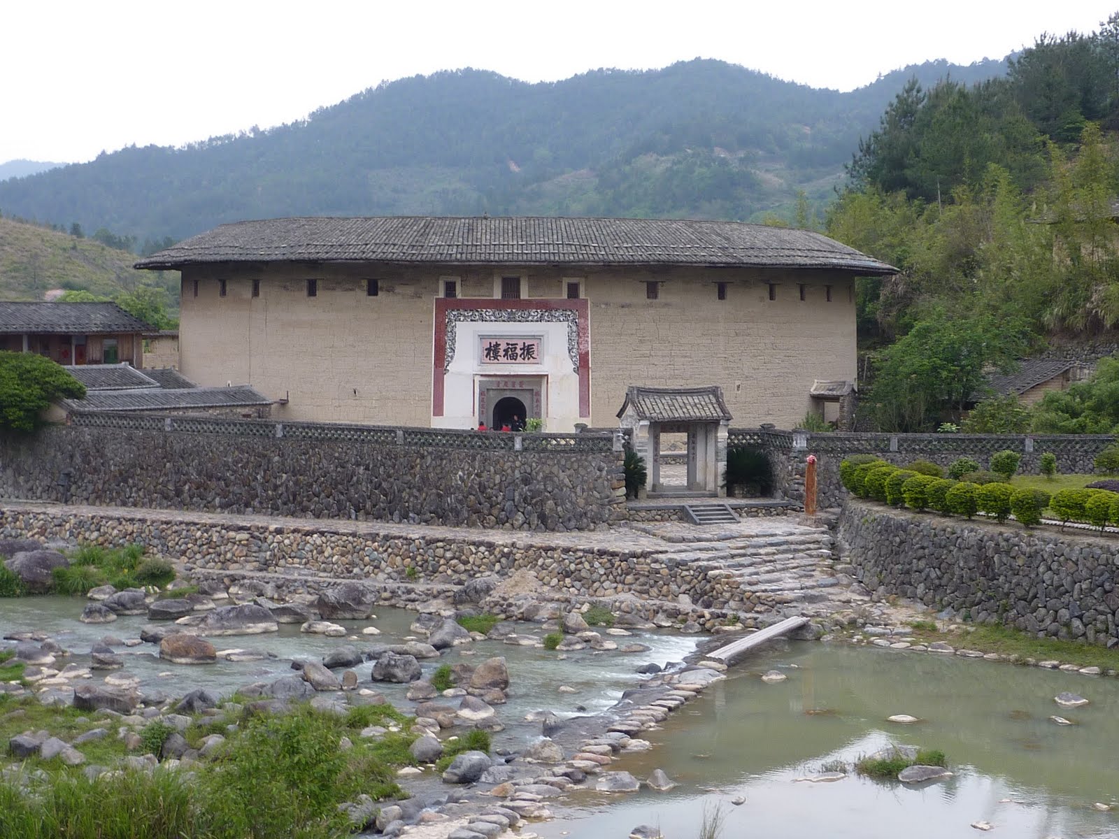 Figure 8Zhenfulou, now a museum on Hakka tulous
The grandfather made his money from tobacco, still grown in the region and built this tulou. The inside courtyard of this roundhouse is particularly elaborate, no doubt a reflection of his wealth and a more modern times.
 Figure 9The altar and meeting hall inside Zhenfulou
The first two floors of Zhenfulou has been converted into a museum on tulous and the Hakka culture. The area surrounding the building is being beautified and will become a future tourist destination as the heart of the Zhenfulou Scenic District.
 Figure 10The stream by the Zhenfulou
 Figure 11Four generations of the Su family
The next morning we headed for the Hongkeng (洪坑村) village and tulou group. Right away, we can see that this cluster is all set to exploit the commercial potential of the recent World Heritage designation. There was a young lady waiting to guide us, and parking for our car was free since we were returning to have lunch at the hotel built at the entrance to the village.
The first major structure to greet us was Zhenchenglou (振成楼) and its prominently displayed World Heritage logo. A contemporary of Zhenfulou, this building has some advanced designs.
 Figure 12Zhenchenglou, Hongkeng village, Yongding
The owner, a Mr. Lin, had designed brick walls on the inside to mark off sections of the building and to act as fire breaks in case the wooden structure should catch on fire.
 Figure 13Inside view of Zhenchenglou
Another advanced design involved the way smoke was led away from the ground floor kitchen to the roof top via channels built inside the wall.
 Figure 14Kitchen smoke duct leading into the wall
Fuyulou (福裕楼 ) is also part of the Hongkeng cluster. This square shaped building is divided into three sections where, in a break with tradition, the youngest brother occupied the middle section while the two older brothers had the two sides.
 Figure 15Inside view of a square tulou
Kuijulou(奎聚楼) built in 1834 is a multileveled building more like a palace; in somewhat of a stretch, the guide said like the Potala Palace in Lhasa.
 Figure 16Kuijulou, Hongkeng village, Yongding
After lunch, we went to the nearby Gaobei (高北) cluster of tulous that included Chengqilou(承启楼), the “king” of tulous, with four concentric circles of buildings, four stories in the outer ring and a total of 400 rooms.
 Figure 17Inside view of the huge Chengqilou
In the same cluster is a very old Wuyunlou(五云楼) that looks shaky even to long time residents of tulou. Most have vacated and now only three elderly citizens have remained. We were told that they love having the run of the place.
 Figure 18Inside view of Wuyunlou, Yongding
A diagrammatic map of Fujian Tulou showed that there are more than 43 sites for tourists to visit, 8 of these are World Heritage sites and another dozen are designated as national treasures. So far availability of various Hakka roundhouse tours is not widely known to foreign tourists and that’s the best time to visit.
Subscribe to:
Posts (Atom)